That’s One Sweet Customer
Wilmar Sugar Engage BuildingPoint Australia to Implement Trimble Technology in their Sugar Mills.
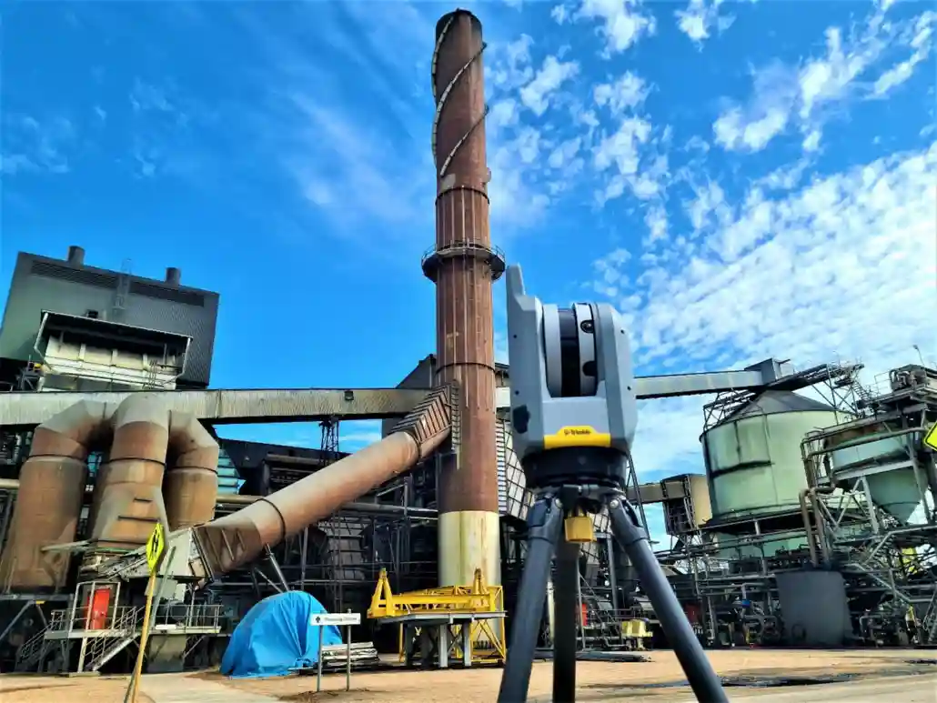
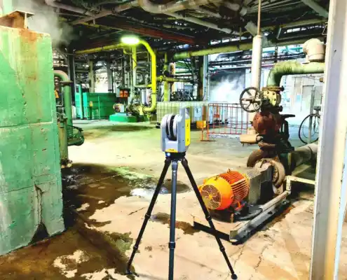
Figure 1. Trimble X7 Scanner at Pioneer Mill, Brandon, Queensland, Australia
There is a whole lot of work that goes into you being able to enjoy that spoon full of sugar in your morning cuppa. On a recent business trip to Pioneer Mill to conduct training, BuildingPoint employees Connor Gallagher and Kieran Dinuzzo learned some of what is involved in the sugar milling process. Wilmar Sugar is a giant in the Australian sugar industry, the nation’s largest manufacturer of raw sugar which accounts for about 50% of Australia’s production. Sugar cane is grown along the Northeast coast of Australia, harvested, and transported to the mills. Macknade Mill near Ingham is the oldest raw sugar mill in Queensland, having started production in 1874. Wilmar’s other factories were established between the 1880s and 1920s. Today, factories have high levels of automation. Ongoing investment in new plants and technologies has ensured they are among the most efficient in the world. Wilmar sought to continue this innovation by engaging BuildingPoint Australia to implement Trimble hardware and software solutions into its sugar mills.
Figure 2. ASMC_Factsheet_Making-Raw-Sugar_web.pdf
Wilmar approached BuildingPoint with a set of problems it needed solving:
- Wilmar was already engaging 3rd parties to conduct laser scans of the mills for maintenance and to create designs/model from the point clouds. The team wanted to move some of this in-house.
- They required a software package to clean the point clouds and a platform to share it with other employees and stakeholders.
- They wanted to streamline the process of modelling from the point clouds through the means of using auto-extraction software for pipes, structures, and beams.
- With the impact of Covid affecting the way we all work, and border restrictions limiting the travel of specialised workers, they needed a tool that would allow for specialists to remotely assist in works on-site.
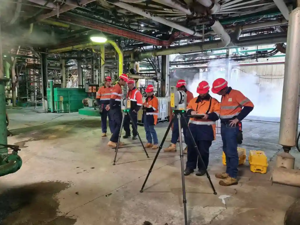
Figure 3. BuildingPoint training Wilmar staff in the use of the Trimble X7 3D laser scanner running FieldLink software
The Trimble X7 3D laser scanner running Trimble FieldLink software on a T100 tablet is an intuitive easy-to-use solution producing accurate and reliable results. The scanner is self-levelling and self-calibrating saving time and money on annual calibrations. The user can do in-field geo-referencing and auto-registration, allowing for the quality of what has been picked up (or missed) to be monitored throughout the day in the field, reducing the need for rework. Depending on what the desired outcomes are for a scan, the scan settings can be changed allowing for low, medium, and high-density scans which affect the scan time, along with the option to capture images: fast (a lower number of images are taken), high (a higher number of images are taken) and the option for HDR (high dynamic range) which assists in bringing out the highlights and contrasts of an image. For the training, all scans were captured with low density and with fast image capture selected. These images can then be overlaid on the point cloud to colourise it.
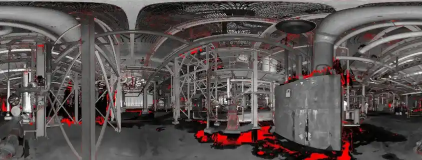
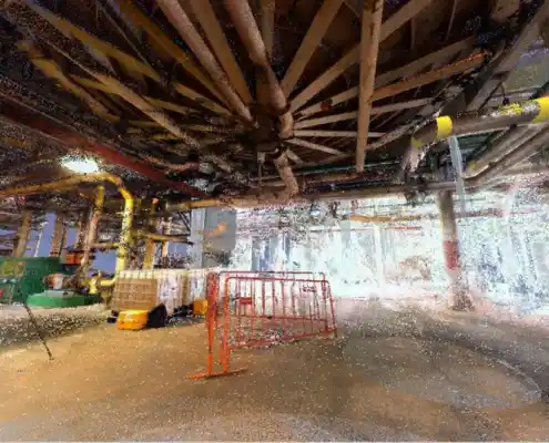
Figure 4. Fast panoramic image capture is taken from the X7 on-site at Pioneer Mill
Conditions in a sugar mill can be hot, loud, and steamy which might seem like fun but provides challenges when laser scanning. Thankfully, Trimble FieldLink software has several tools which allow the user to check what has been captured successfully. Within the station view, there are four viewing options: grayscale, true colour, unmeasured points, and scan intensity. The unmeasured points viewing option allowed for the team to assess if any steam was in the way of what they were aiming to capture. All items that are shown in black/grayscale have been successfully captured and those showing in red mean there was no data or poor data captured. From this, a decision is made in the field as to whether or not another scan is required. It’s worth mentioning that most of the scanning will not be done in the crushing season, so there will be less interference from steam during this time. Nonetheless, it is a handy tool to fall back on.
Figure 5. A station view within FieldLink shows unmeasured points in red, allowing the user to make an assessment if another scan is required or not, saving time on rework.
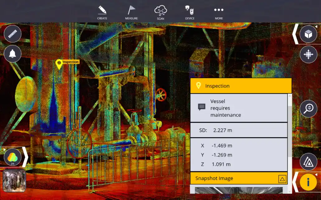
The field crew can also make annotations and add markers on the scan for information that is important and may need to be relayed back to engineers, drafters, and maintenance staff. The annotations have X, Y, and Z coordinates, and a photo can be captured using the T100 tablet and is pinned to the annotation marker. This can then be exported directly from the tablet.
Figure 6. Screen capture of Trimble FieldLink showing the adding of an annotation marker to the scanned point cloud.
Once the scans are complete, they are refined in the field and a report is produced advising on the reliability, overlap, and confidence of each scan. It can then be exported to a range of formats including RCP, E57, TDX, LAS, POD, and TZF files. The scan is now ready to be imported into Cloud Engine.
Trimble Cloud Engine is a desktop point cloud software. It performs several core roles including scan data management (registration/georeferencing), point cloud clean up (segmentation/sampling), analysis/comparison to 3D models/other clouds, and point cloud sharing. Wilmar may have many software workflows depending on the task, but to take one example; Cloud Engine can be used for integration of scan data from different sources/times, and then the data can be prepared for use in Edgewise. Which we will touch on in detail below.
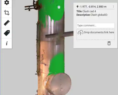
After modelling of the proposed new works is completed in Edgewise/Autodesk, models can be brought back into the Cloud Engine project to run clash checks and/or heatmap analysis. These steps can be published to a free shareable viewer to allow other teams within Wilmar to provide their input on the proposed works.
Figure 7. Screen capture of Trimble Cloud Engine performing a heat map analysis of a vessel captured in the point cloud and comparing it to a model.
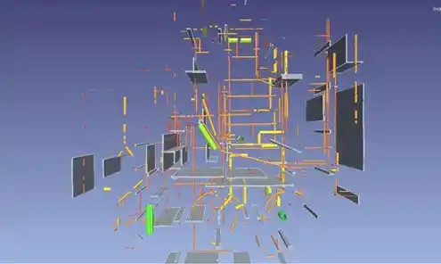
Within the mills, there is a lot of infrastructure and piping to keep the functionality running smoothly. This can make modelling from the point cloud rather difficult as it is quite busy. This is where Trimble Edgewise comes into play. Edgewise allows for pipes, beams, floors, and structures to be automatically extracted and modelled. The point cloud is imported in from Cloud Engine, and the user can select what features they would like the software to automatically extract.
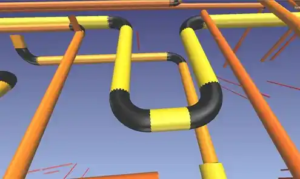
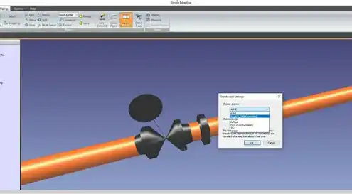
Figure 8. Screen captures from Trimble Edgewise showing 1. The importation of the point cloud. 2. The automatic pipe extraction. 3. Automated pipe connections using the Easy Connection tool
Pipe connections and elbows can be automatically fitted using the Easy Connect tool. Other fittings such as tees and reducers can be manually fitted to the cloud. The user can then apply standards with predefined pipe specifications, which will resize the pipes according to spec and refit them to the point cloud. The user can then also fit valves and flanges to the standardised pipes. When the model is complete the user can export it to a chosen format. There is a direct export to Revit which keeps the properties of the pipes etc, making it fully compatible with Revit/Autodesk models.
Figure 9. Screen capture of Trimble Edgewise showing a fitting to Australian Standard AS NZS 2280
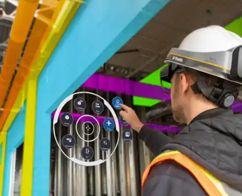
Once the models are complete, they can be distributed to the participating stakeholders. A model visualisation tool that can be used to view the models to scale in the real world is the Trimble XR10 with HoloLens 2. The user can align the designed model to the work area in the real world. As the user moves around the site, they will be able to visually see where the designed components sit, which can assist with issues such as clash detection. The Trimble XR10 meets all construction safety standards, the XR10 chassis fits into an industry-standard MSA V-Gard hard hat which can be changed. It also has bone-conducting speakers, allowing for the user to wear ear protection whilst being able to still hear the audio from the device. It also meets electrical standards protection requirements, and the glass meets safety standards.
Figure 10. A Visualisation of what the user of the XR10 will be seeing in the field
Steps or sequencing can be created for the XR10 allowing for the user to be guided through a work process much like a manual and it could be used in works such as removing or replacing plant items. This is done through the Trimble app in the HoloLens 2 called Trimble Connect. On the back of this Microsoft Remote Assist may be utilised to enable input from offsite specialists.
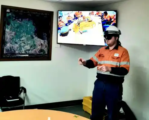
Figure 11. A Wilmar Employee receiving training in the Trimble XR10. The user is manipulating a placed dozer model on the screen.
Richard Fallon – Wilmar Design Engineer reflected on his experience with BuildingPoint and the Trimble products “The on-site Trimble training was an excellent overview on how to operate the X7 scanner, as well as a solid introduction to using the Trimble Cloud Engine and Edgewise software.
We operate eight sugar mills across a 550km area, and we complete both maintenance and capital drafting for all these sites. The X7 allows us to scan multiple jobs that can be taken back to a central point for drafting.
We have already used the Trimble X7 at one of our sites, where there was some damage to large high-level injection water pipework. The X7 allowed us to scan the pipework, without requiring scaffolding and site measurement. We were able to take the scan back to our office and back-model the existing pipework, allowing us to get accurate drawings for the new pipework required. It allowed our engineers to assess potential repairs before a budget had been applied to the project”.

